Monitoring of the soil quality and vegetation using data of remote sensing in the Ukraine : Project completion report
50
0
0
Hele tekst
(2) Monitoring of the soil quality and vegetation using data of remote sensing in Ukraine Project completion report RIVM Letter report 680271001/2012 B. Fraters et al..
(3) RIVM Letter report 680271001. Colophon. © RIVM 2012 Parts of this publication may be reproduced, provided acknowledgement is given to the 'National Institute for Public Health and the Environment', along with the title and year of publication.. B. Fraters, RIVM K. Kovar, PBL S. de Jong, University of Utrecht H. Bartholomeus, Wageningen University V. Grekov, Centerderzhrodyuchist V. Panasenko, Centerderzhrodyuchist Contact: Dico Fraters Centre for Environmental Monitoring dico.fraters@rivm.nl. This investigation has been performed by order and for the account of NL Agency, within the framework of project G2G/09/UA/6/1. Page 2 of 48.
(4) RIVM Letter report 680271001. Abstract. Monitoring of the soil quality and vegetation using data of remote sensing in Ukraine. Project completion report. Ukraine faces large challenges, as wind and water erosion endanger its highly productive, but vulnerable loess soils. Remote sensing and GIS provide tools to monitor vast areas at relatively low cost. These tools can be used to determine the areas threatened by erosion. In addition, they are suitable to monitor the effectiveness of measures against erosion. This way, necessary soil monitoring is less depending on costly on-ground monitoring stations. These findings are the result of research carried out by the National Institute for Public Health and the Environment (RIVM) in co-operation with various Dutch and Ukrainian experts by order of NL Agency. Increasing needs and decreasing budget The incentive of this research was the decreasing budget of the Ukrainian State Centre for Soil Fertility and Product Quality, Centerderzhrodyuchist. This institute is responsible for soil quality monitoring in Ukraine as well as soil fertility analysis and advises. To assure sufficient food production in the near future, the need for detailed monitoring and information collection is increasing. Safeguarding existing information In addition to proposals for alternative monitoring systems, the project looked into options for digitalising Ukrainian soil data. The huge set of maps, results of lab analysis and field surveys, et cetera, in the possession of the institute, are mainly set down and recorded on paper. It is important to safeguard this irreplaceable information for trend analysis and to have them in a digital form. The infrastructure of the Global Soil Data Mapping project provides a suitable and cost-effective tool for this purpose. Increasing the agricultural area In closing, the project made a start with looking into an affordable technique and whether this technique could be used to determine the ‘pollution state’ of agricultural soil that were lost for production as a consequence of the accident with the nuclear power plan in Chernobyl. Ukrainian experts assume that the contamination of the soil has been reduced over the last 25 years in such a way that in some areas the land is suitable again for growing agricultural crops safe for human consumption. They will continue this research outside the framework of this project.. Keywords: soil quality, monitoring, remote sensing, GIS. Page 3 of 48.
(5) RIVM Letter report 680271001. Rapport in het kort. Monitoring van bodemkwaliteit en vegetatie in Oekraïne met gebruik van aardobservatiegegevens. Afsluitend projectrapport. Oekraïne heeft te kampen met wind- en watererosie, die de vruchtbare maar ook kwetsbare lössgronden bedreigen. Aardobservatie en geografische informatiesystemen (GIS) bieden de mogelijkheid om tegen relatief lage kosten grote bodemoppervlakten te monitoren. Met deze middelen kan worden vastgesteld welke gebieden door erosie worden bedreigd. Daarnaast zijn ze geschikt om de effecten van maatregelen tegen erosie te monitoren. Op deze manier is de noodzakelijke bodemmonitoring minder afhankelijk van kostbare grondstations. Dit blijkt uit onderzoek dat het RIVM in samenwerking met diverse Nederlandse en Oekraïense deskundigen heeft uitgevoerd in opdracht van Agentschap NL. Toenemende behoeften en afnemende budgetten Het onderzoek is ingesteld vanwege de afnemende budgetten van het Oekraïense Staatsinstituut voor Bodemvruchtbaarheid en Productkwaliteit Centerderzhrodyuchist. Dit instituut is verantwoordelijk voor zowel de monitoring van bodemkwaliteit als voor bodemvruchtbaarheidanalysen en bemestingsadvies. Om voldoende voedselproductie voor de toekomst zeker te stellen, neemt de behoefte aan gedetailleerde monitoring en informatieverzameling juist toe. Bestaande informatie veiligstellen Behalve voorstellen voor alternatieve monitoringssystemen, is uitgezocht hoe data over bodemgegevens van Oekraïne het beste kunnen worden gedigitaliseerd. De vele kaarten, laboratoriumanalyses, veldwaarnemingen enzovoort, waar het land over beschikt zijn voornamelijk op papier vastgelegd. Voor trendanalyses is het van belang deze gegevens veilig te stellen en digitaal beschikbaar te hebben. De infrastructuur van het ‘Global Soil Data Mapping’project blijkt hiervoor een geschikt en kosteffectief instrument. Uitbreiding van het landbouwareaal Ten slotte is een start gemaakt met onderzoek waarbij wordt gekeken of met een betaalbare techniek de mate van verontreiniging kan worden beoordeeld van de landbouwgrond die 25 jaar geleden verloren is gegaan door het ongeluk met de kerncentrale in Tsjernobyl. Naar verwachting is de verontreiniging dermate sterk verminderd dat in bepaalde gebieden de bodem weer kan worden ingezet om agrarische gewassen te verbouwen. Dit onderzoek wordt door de Oekraïense experts voortgezet buiten het kader van dit project.. Trefwoorden: bodemkwaliteit, monitoring, aardobservatie, GIS. Page 4 of 48.
(6) RIVM Letter report 680271001. Contents. Summary—7 1. Introduction—9. 2. Project results—11. 3. Project activities—16. 4. Cooperation between team and Centerderzhrodyuchist—17. 5. Programme objective—18. 6. Project effect and sustainability—19. 7. Dutch economic interests—20. 8. Important developments—21. 9. Follow-up and recommendations—22. 10 10.1 10.2. Publication text—23 Remote sensing in Ukraine—23 Aardobservatie voor bodemmonitoring in Oekraïne—23 Appendix 1 Report of inception mission—25 Appendix 2 Report of study visit and training mission—33 Appendix 3 Report of final mission—38 Appendix 4 Blueprint setup for implementations of remote sensing and GIS in soil quality monitoring in Ukraine—43. Appendix report (RIVM report number 680271001A) The appendix report contains the power point presentations presented by Ukrainian and Dutch experts during the project missions.. Page 5 of 48.
(7) RIVM Letter report 680271001. Page 6 of 48.
(8) RIVM Letter report 680271001. Summary Ukraine faces large challenges in order to protect and, if possible, to improve the quality of soil and water. The State Technological Centre of Soil Fertility and Products Quality (Centerderzhrodyuchist) is the institute in Ukraine responsible for monitoring the quality of agricultural soils, both from the perspective of soil fertility and of environmental protection, including studying the radioactive contamination status (Chernobyl). To support the Ukrainian government NL Agency developed a project to enable Centerderzhrodyuchist to develop policy and effective control measures according to EU standards on Ukrainian soil protection by using the technique of geographic information systems (GIS) and earth observation. The Dutch Ministry of Economic Affairs financed this project. A Dutch consortium, consisting of the National Institute for Public Health and the Environment (RIVM), PBL Netherlands Environmental Assessment Agency (PBL), the University of Utrecht and the Wageningen University, carried out the project in 2011-2012. Nine other Ukrainian institutions and organisations, both public and private, were involved in at least one of the project missions to ascertain that all relevant parties in Ukraine could give input to the project and benefit from the outcome. The project consisted of three missions, two in Ukraine (Kiev and Odessa) and one in the Netherlands. Centerderzhrodyuchist and the Dutch team conducted a need and gaps analysis; Ukrainian experts orientated themselves on Netherlands and EU best practices in the field of the application of geographic information systems for soil protection. In addition, the experts of Centerderzhrodyuchist were enabled to create a blueprint for the implementation of Dutch and/or EU best practices in the field of soil protection by the application of remote sensing in combination with geographic information systems. The cooperation between the Dutch team and the Ukrainian team has been very close and effective, despite the language problems. The project has increased the awareness of Ukrainian experts of the state of art of remote sensing and GIS in the Netherlands and the EU, as well as approaches used in the Netherlands to prepare and implement new technology in existing monitoring networks given political, scientific, and budgetary constraints. Given the wide range of organisations and the large number of experts involved, it is presumed that the knowledge and skills acquired will be sustainable. The Dutch team presented an overview of small and medium size Dutch enterprises active in the field of remote sensing and/or GIS. Three companies gave presentations and contacts were established between Centerderzhrodyuchist and representatives of these companies. To safeguard, and prevent loss of, irreplaceable analogue soil data for future use, the infrastructure created by the Global Digital Soil Mapping project should become available to Centerderzhrodyuchist. There also is a need for more detailed information and for training of staff of Centerderzhrodyuchist in acquiring, using, storing and analyzing GIS and remote sensing data and in the use of computer programmes to facilitate this data processing and analysis.. Page 7 of 48.
(9) RIVM Letter report 680271001. Page 8 of 48.
(10) RIVM Letter report 680271001. 1. Introduction. Ukraine faces large challenges in order to protect and, if possible, to improve the quality of soil and water. The reasons are the increasing demands for agricultural products, large changes in land ownership and decreasing government budgets for soil quality monitoring. In 2008-2009 Dutch and Ukrainian organisations carried out an evaluation of Ukraine soil monitoring efforts in relation to the EU Soil Framework Directive. The Dutch organisations were the National Institute for Public Health and the Environment (RIVM), PBL Netherlands Environmental Assessment Agency (PBL) and the consultancy firm Acacia Water BV. The Ukrainian partner was the State Technological Centre of Soil Fertility and Products Quality (Centerderzhrodyuchist). The evaluation showed that Ukraine monitoring systems for soils were – in terms of the extent and the quality of obtained data – in very good state. However, there was no systematic monitoring or data collection of soil erosion since the Institute for Soil Protection had been closed. Some threats for the monitoring system were specified, especially for the agrochemical passportisation monitoring network, due to decrease in funding for passportisation. Soil quality monitoring was not integrated with other monitoring efforts in Ukraine, for example, with monitoring systems for other EU Environmental Directives. It was recommended to evaluate risks of information loss due to a decrease in monitoring for passportisation, to review necessity to monitor non-agricultural areas and need for structural collection of information on erosion and land slides, to study reporting by EU member states to the European Commission, and to consider integration of soil, groundwater and surface water monitoring systems that can be used for monitoring for several EU Environmental Directives. Point of concern was that there was no (adequate) system for SFD monitoring of soil contamination (point source soil pollution), and the evaluation of risks for environment and human health in order to control and abate point source / local problems. It was recommended to set-up a system for making an inventory of (possibly) polluted sites and a system for evaluating environmental and human health risks of polluted sites. The outcome of this evaluation of the soil quality monitoring efforts resulted in two requests from the Ukrainian government for support. One request regarded the support for a project to tackle the problem of increasing need for monitoring with declining budgets by looking at opportunities to use remote sensing data for monitoring purposes. The second request regarded the support for a project to tackle the problem of point sources of pollutions especially with regard to risk assessment of abandoned sites for storage of agricultural chemicals (fertilisers and pesticides). This report is the final or completion report on the project that looks at opportunities to use remote sensing data for monitoring purposes and is officially called “Monitoring of the soils quality and vegetation using data of remote sounding of the earth”. Page 9 of 48.
(11) RIVM Letter report 680271001. NL Agency developed this project and the Dutch Ministry of Economic Affairs, Agriculture and Innovation funded it. The project code used by NL Agency is G2G09/UA/6/1. Hereafter the project name is abbreviated to “remote sensing project”. The project has been carried out by a Dutch consortium consisting of RIVM, PBL, the University of Utrecht and the Wageningen University. The Ukrainian counterpart and beneficiary organization is the Ukrainian State Technological Centre of Soil Fertility and Products Quality, hereafter shortened to Centerderzhrodyuchist. Centerderzhrodyuchist was formerly called in English the State Technological Centre on Soil Fertility Protection, Centerderzhrodyuchist falls under the Ministry of Agricultural Policy of Ukraine. The purpose (programme objective) of this project is to enable Centerderzhrodyuchist to develop policy and effective control measures according to EU standards on Ukrainian soil protection by using the technique of geographic information systems (GIS) and earth observation. To reach this objective NL Agency defined project results and projects activities in advance. The results and activities are presented and discussed in chapter 2 (results) and chapter 3 (activities). Chapter 4 discusses the cooperation between the Dutch organisations and Centerderzhrodyuchist and chapter 5 the programme objectives. The following chapters will deal with project effect and sustainability (chapter 6), Dutch economic interests (chapter 7), important developments (chapter 8) and follow up and recommendations (chapter 9). A text (Dutch and English version) for publication that summarises the project and its results is given in chapter 10.. Page 10 of 48.
(12) RIVM Letter report 680271001. 2. Project results. The project plan defines the following project results A needs and gaps analysis has been conducted by which the Ukrainian Ministry of Agrarian Policy is made aware of the needs and gaps in its technical, institutional and legal system facilitating the technique of remote sensing and geographic information systems (GIS). The Ukrainian Ministry of Agrarian Policy has orientated itself on Netherlands and EU best practices in the field of the application of geographic information systems for soil protection. Experts from Centerderzhrodyuchist have been enabled to create a blueprint for implementation of Dutch and/or EU best practices in the field of soil protection by the application of remote sensing in combination with geographic information systems. The next three sections discuss the results. For details, we refer to the appendices included in the report and the appendices in the Appendix report. A need and gaps analysis Centerderzhrodyuchist has carried out a need and gaps analysis during the project. Researchers presented essential aspects of the analysis during mission workshops. Aspects were discussed with the members of the Dutch team and colleagues from Centerderzhrodyuchist, regional centres and/or other Ukrainian organisations. Aspects discussed in more detail were: Legal framework in Ukraine for remote sensing and key players (Appendix report, appendix 2). Mission of Centerderzhrodyuchist (Appendix report, appendix 30). Current use of remote sensing in monitoring of Ukrainian agro-resources (Appendix report, appendix 5 and 29). ‘Research, monitoring and evaluation’, determination of natural resources problem with assistance of remote sensing (Appendix report, appendix 12). Overview of techniques and approaches of earth observation and GIS to be implemented in soil quality monitoring in Ukraine (Appendix report, appendix 31 and 32). The Ukrainian law on space activities of November 1996 and other legal acts adopted in conformity aims, among others, at the development of space science and technology that shape sustainable development of the national economy. One of the objectives of the space programme 2008-2012 is to implement remote sensing to solve problems of resource monitoring and the development of international cooperation in remote sensing. For monitoring of agricultural soils, the Act no. 51 of 26 February 2004 mentions in addition to the soil monitoring network the use of remote sensing. In addition to Centerderzhrodyuchist seven other institutes are involved in remote sensing in relation to monitoring of soil. These institutes are: Institute for Forecasting and testing techniques and technologies for agricultural produce them. L. Pogorilov; National Research Institute of Soil Science and Agricultural Chemistry A.N. Sokolovsky NAAS; Institute of Agroecology NAAS; Institute of Hydraulic Engineering and Land Reclamation NAAS; Page 11 of 48.
(13) RIVM Letter report 680271001. National Space Agency of Ukraine; Space Research Institute of NAS of Ukraine and NSA of Ukraine; Centre for Aerospace Research of the Earth of NASU. Some universities play an important role in GIS, such as the National University of Life and Environmental Sciences (NUBaP). Centerderzhrodyuchist is the institute in Ukraine responsible for monitoring of the quality of agricultural soils, both from the perspective of soil fertility as of environmental protection, including studying radioactive contamination status (Chernobyl). The regional centres also function as consultancy agency for farmers. GIS and remote sensing techniques and similar approaches are already used in Ukraine, but mainly within research settings and projects, for example, in the Lvov region to create a geo-information system of soil status observation and land use monitoring (Appendix report, appendix 3), to study the effect of dust storms (Appendix report, appendix 4), to classify land degradation due to erosion (Appendix report, appendix 9), to monitor the crop status (Appendix report, appendix 10 and 11), for irrigation planning (Appendix report, appendix 12), and in characterising grape plantations and evaluating perspectives in winegrowing areas (Appendix report, appendix 27). However, remote sensing and GIS are not yet used on a regular and operational basis in soil quality monitoring. Current soil quality monitoring is expensive and government budgets are under pressure. In addition, soil fertility tests of agricultural soils are no longer seen as a government task since land ownership is privatised. Therefore, information on soil fertility status will no longer be available on a national level, unless specific regulations are drawn up. Given these developments, Centerderzhrodyuchist sees a necessity for use of remote sensing and GIS in soil quality monitoring to overcome the loss of information due to a decrease of soil sampling and on spot observations. An important gap is seen in the field of soil databases in combination with GIS to safeguard the soil information collected over the last decades. Centerderzhrodyuchist sees cooperation with the Global Soil Data Mapping project as one of the main options (Appendix report, appendix 31). Secondly, a vast area of agricultural land is currently not in use due to radioactive pollution after the Chernobyl accident. Centerderzhrodyuchist estimated that certain areas might have become ‘save to use’ again due to natural decay of radioactivity (Cs-137 contamination) after 25 years. Remote sensing and near by sensing (or proxy-sensing) offer opportunities to newly designate agricultural areas save to use and not save to use. Centerderzhrodyuchist sees the ‘Mole’ device as an important tool (Appendix report, appendix 31 and 32). Centerderzhrodyuchist defines three potential obstacles for implementation of suggested options for use of remote sensing and GIS in soil quality monitoring (Appendix report, appendix 31): Financial: absence of funds for purchasing GIS technologies. I.e. hardware, software and support. Centerderzhrodyuchist and regional centres are state budget organisations. Currently, the budget provides for costs of salary and assignments only. Political: political changes, for example after elections, may have consequences for management staff at the Ministry of Agrarian Policy and, Page 12 of 48.
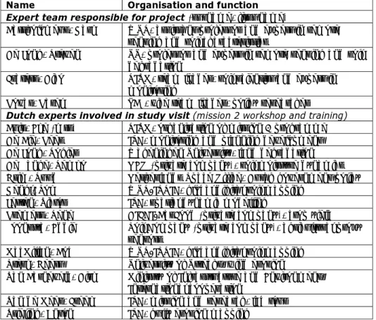
(14) RIVM Letter report 680271001. . therefore, for the relationship between Centerderzhrodyuchist and the ministry. Organisational: o Absence of qualified specialists in RS, GIS technologies and database management in Centerderzhrodyuchist system (low salary; lay-offs in 2009); o Absence of single vision as to managements of regional “Oblderzhrodiuchist” centres as to methods and software to unify the database and its functioning.. Orientation on Netherlands and EU best practices To provide a broad overview of Netherlands and EU best practices in the field of the application of geographic information systems for soil protection the Dutch expert team included co-workers of two universities in the Netherlands playing a key role in this field, Wageningen University and Research Centre (WUR) and the University of Utrecht (UU) (see Table 1). Several other co-workers of these universities were involved in a study visit of a group of Ukrainian experts to the Netherlands. ITC, the expert centre on information technology of the University of Twente, a third key player with respect to GIS and remote sensing in the Netherlands, was strongly involved in the study visit as well. Table 1 Team of Dutch experts and Dutch experts involved in study visit Name Organisation and function Expert team responsible for project (surname, first name) Bartholomeus, Harm WUR, assistant professor and expert in remote sensing and soil characteristics De Jong, Steven UU, professor and expert in remote sensing and soil degradation Fraters, Dico RIVM, team leader, soil scientist and expert in monitoring Kovar, Karel PBL, vice team leader, policy researcher Dutch experts involved in study visit (mission 2 workshop and training) Buis, Eke (mrs) RIVM, organisation of mission 2 programme De Bie, Kees ITC, monitoring and planning development De Jong, Rogier Wageningen University, land degradation De Lange, Remko NEO (private company), soil moisture dynamics Grim, Ruud Netherlands Space Office, Dutch government policy Hengl, Tom WUR/ISRIC, global digital soil mapping Jetten, Victor ITC, spatial dynamic modelling Kremers, Rene DIFCI/BasFood (private company), crop yield Loonstra, Eddie Soil Company (private company), agricultural proxy sensors MacMillan, Bob WUR/ISRIC, global digital soil mapping Sterk, Geert University of Utrecht, wind erosion Van Barneveld, Dirk Ministry of Infrastructure and Environment, International cooperation Van de Meer, Freek ITC, mission and research, lab tour Vrieling, Anton ITC, gully erosion mapping. From the Ukrainian side, ten institutions and organisations, both public and private, were involved in at least one of the project missions (see Table 2) to ascertain that all relevant parties in Ukraine could give input to the project and Page 13 of 48.
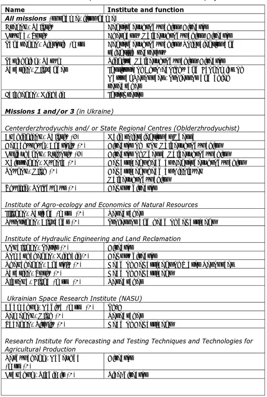
(15) RIVM Letter report 680271001. benefit from the outcome. Centerderzhrodyuchist was not only represented by experts from the national centre, but also by directors and/or experts from regional centres. Representatives of five regional centres participated in the project (Cherkassy, Lvov, Nikolayev, Odessa, Vinnitsa), and one mission (the final) was held at a regional centre (Odessa). Table 2 List of Ukrainian experts involved in one or more of the project missions Name Institute and function All missions (surname, first name) Grekov, Valeriy Centerderzhrodyuchist, Director Kryvda, Yuriy Cherkassy Oblderzhrodyuchist, Director Panasenko, Viktoria (mrs) Centerderzhrodyuchist, Soil scientist and scientific secretary Pasichniak, Vasyl Vinnitsa Oblderzhrodyuchist, Director Tarariko, Olexander Institute of Agro-ecology and Economics of Natural Resources, Professor and chief researcher Falchenko, Mikhail Interpreter Missions 1 and/or 3 (in Ukraine) Centerderzhrodyuchis and/ or State Regional Centres (Oblderzhrodyuchist) Avchinnikov, Valeriy (3) Main soil scientist at Odessa Demchyshyn, Anatoliy (1) Director of Lvov Oblderzhrodyuchist Kulidzhanov, Grigoriy (3) Director of Odessa Oblderzhrodyuchist Maistrenko, Mykola (1) Department head at Centerderzhrodyuchist Voynov, Oleg (1) Department head at Nikolayev Oblderzhrodyuchist Zhylkin, Volodymyr (1) Deputy director Institute of Agro-ecology and Economics of Natural Resources Illenko, Tatiana (mrs) (1) Researcher Syrotenko, Alexandr (1) Professor and head of department Institute of Hydraulic Engineering and Land Reclamation Kovalenko, Peter (1) Director Romashchenko, Mikhail (1) Deputy director Shevchenko, Anatoly (1) Head of Department of Water Resources Tarariko, Yuriy (1) Head of Department Vlasova, Elena (mrs) (1) Researcher Ukrainian Space Research Institute (NASU) Adamchuk, Nadiya (mrs) (1) Ph.D Semenov, Oleg (1) Researcher Yacenko, Vitaliy (1) Head of Department Research Institute for Forecasting and Testing Techniques and Technologies for Agricultural Production Serdyuchenk, Nadezhda Director (mrs)(1) Kravchuk, Vladimir (1) Vice-director. Page 14 of 48.
(16) RIVM Letter report 680271001. State Company «Dniprocosmos» Bushuev, Eugene (1) Chief researcher Macepura, Andrei (1) Chief of Unit State Scientific Production Centre Nature Georgiy, Veruzhskiy (3) Scientist Grekov, Leonid (1,3) Professor and director V.Y. Tairov Institute of Viticulture and Winemaking Bulayeva, Yuliya (mrs) (3) Scientist Lyashenko, Galina (mrs) (3) Deputy director Kuzmenko, Artem (3) Scientist Other companies or institutions Kozariz, Yuriy (3) Prymula-P (private company) Docenko, Igor (3) Committee of Biosafety (NGO). A general overview of Netherlands and EU best practices in the field of the application of geographic information systems for soil protection was presented both in Ukraine and in the Netherlands (Appendix report, appendix 6, 7, 8, and 22). More detailed and in depth information was presented at workshops and training sessions during the study visit to the Netherlands (Appendix report, appendix 15 up to 22 and 23 up to and including 26). Experts from Centerderzhrodyuchist enabled to create a blueprint The concept of a blueprint has been discussed briefly during the first mission and more in depth during the second mission. The Dutch experts drafted a blueprint setup that was sent to Centerderzhrodyuchist. Experts from Centerderzhrodyuchist have elaborated on this draft in the period between the two missions and presented a discussion version during the third and last mission seminar (Appendix report, appendix 28). The final version of the blueprint set up is included as Appendix 4 of this project completion report.. Page 15 of 48.
(17) RIVM Letter report 680271001. 3. Project activities. The project plan defined the following project activities: An inception mission during which the project activities will be specified and agreed upon by Ukrainian and Dutch parties; A study visit of a Ukrainian delegation comprising max. 8 Ukrainian experts to the Netherlands visiting, among others, the Netherlands Ministry of Infrastructure and the Environment (including the Soil Desk Initiative) or the National Cooperative Council for Agriculture, including a network event comprising Dutch and Ukrainian stakeholders (among others, Dutch relevant business); Workshops/training on a Dutch and/or EU best practice for the Ukrainian situation regarding techniques of earth observation (remote sensing) and by applying geographic information systems; A closing seminar presenting the results of the project and informing Dutch and Ukrainian stakeholders in Ukraine. The plan states that the complete programme will be closely coordinated with the Dutch Ministry of Infrastructure and the Environment and the Agricultural Attaché of the Netherlands Embassy in Kiev. The project consisted of three missions that included the above mentioned four project activities: Mission 1, the inception mission of the Dutch expert team to Ukraine from 21-24 February 2011 (Appendix 1). Mission 2, a study visit of the Ukrainian expert team to the Netherlands from 4-8 July 2011, during which workshops and training were organised (Appendix 2). Mission 3, final mission of the Dutch expert team to Ukraine from 12-14 September 2011 during which a closing seminar was held at the regional centre in Odessa (Appendix 3). The Dutch team cooperated with Mr Dirk van Barneveld and Mr Wout de Vogel as representatives of the Ministry of Infrastructure and the Environment to coordinate the programme. The team also closely cooperated with Mr Ruud Grim of the Netherlands Space Office, the face of the Dutch space community for international space organisations like ESA, NASA and JAXA as well as the central point of contact for the space community within the Netherlands. The Dutch team stayed in contact with the Netherlands Embassy in Kiev during the entire project. Mission reports were sent to the Embassy after each mission and a meeting was arranged in May 2011 when the team was in Kiev for another related project, as the planned meeting at time of the inception in February was cancelled because of other obligations of the representative of the Embassy.. Page 16 of 48.
(18) RIVM Letter report 680271001. 4. Cooperation between team and Centerderzhrodyuchist. The Dutch team responsible for the project consisted of four members from different institutions (see Table 1). The team leader and vice team leader were responsible for a previous project carried out in Ukraine in 2008-2009 (G2G07/UA/6/1) evaluating the Ukrainian soil quality monitoring efforts in view of the upcoming European Soil Framework Directive. That project led to the current (second) project (G2G09/UA/6/1) and a third project (G2G09/UA/6/2) about risk evaluation of abandoned storage sites for agri-chemicals. That third project was carried out in the same period as the current (second) project with the same team leader and vice team leader. The two experts from the universities on the team were not involved in the other related projects. The core of the Ukrainian team consisted of the director of Centerderzhrodyuchist, the scientific secretary, the directors of the regional centres in Cherkassy and Vinnitsa and a professor of the Institute of Agroecology and Economics of Natural Resources (see Table 2), these experts participated in study visits and were involved in at least one of the other two missions. All experts had also been involved in the previous project in 20082009 and, with the exception of the regional directors, were involved in the third project. The cooperation between the Dutch team and the Ukrainian team has been very close and effective, despite the fact that most of the members of the Ukrainian team did not or did hardly speak or understand English. Only the scientific secretary has a command of English well enough for basic conversation. The understanding of English increased during the project(s) in 2011, especially the English of the director and the scientific secretary improved. Between the second and third mission some of the e-mail correspondence took place without intervention of the interpreter. The interpreter, who was involved in all three projects, played an important role, and certainly contributed to the success of the projects and the mutual understanding of Dutch and Ukrainian experts. To ensure full comprehension of the materials discussed all essential presentations and documentation have been made available in both English and Ukrainian. The teams developed the mission programmes together. The experts of the Ukrainian team had a clear view of the objectives and were inclined to prepare missions carefully in advance. This made it possible to limit the number of missions within the project to three, the maximum number of missions possible due to decreased project budget compared with the first project with four missions in the 2008-2009 period.. Page 17 of 48.
(19) RIVM Letter report 680271001. 5. Programme objective. Programme objective, as stated in the project plan, is to enable the Ukrainian State Technological Centre of Soil Fertility and Products Quality, 'Centerderzhrodyuchist’, to develop policy and effective control measures according to EU standards on Ukrainian soil protection by using the technique of geographic information systems (GIS) and earth observation. The experts of Centerderzhrodyuchist and other Ukrainian experts involved in the project have been made aware of discussions within the scientific and political arena in the Netherlands and the EU with respect to soil quality (for example, Appendix report, appendix 1) and remote sensing (for example, Appendix report, appendix 13 and 14). A wide spectrum of remote sensing techniques and approaches has been discussed in course of the project. This techniques and approaches regarded both ones already in use in Ukraine and new ones (for example, Appendix report, appendix 6 and 7). At the seminar, during the last mission, the Ukrainian experts presented their ideas for future use of remote sensing and GIS within the existing structure for soil quality monitoring in Ukraine based on an evaluation of new techniques available. They showed ways to implement these new techniques and took into consideration factors that might form obstacles for implementation. They also presented a set up for a blueprint, a concept that could be used to generate the necessary budget for the implementation (Appendix report, appendix 28 up to and including 32).. Page 18 of 48.
(20) RIVM Letter report 680271001. 6. Project effect and sustainability. The current project on ‘Monitoring of the soils quality and vegetation using remote sensing data’, is one of the three projects carried out by a Dutch team in cooperation with Centerderzhrodyuchist. A first project, evaluating the Ukrainian soil monitoring effort in view of the upcoming EU Soil Framework Directive, was carried out in 2008-2009 and resulted in two new projects. These new projects have been carried out in 2011-2012, almost concurrently, and they aimed at improving the soil quality monitoring efforts and making them more efficient. Centerderzhrodyuchist is a strong and leading institute in soil quality monitoring in Ukraine with qualified personnel and regional centres in each of the provinces (oblast). Directors of regional centres exchange information with Centerderzhrodyuchist and with each other. Centerderzhrodyuchist has good relations with other Ukrainian institutes operating in adjoining fields of action. The project has increased awareness of Ukrainian experts of the state of art of remote sensing and GIS in the Netherlands and the EU, as well as approaches used in the Netherlands to prepare and implement new technology in existing monitoring networks given political, scientific, and budgetary constraints. In addition to Centerderzhrodyuchist nine Ukrainian institutions and organisations, both public and private, were involved in at least one of the project missions (see Table 2). Directors and researchers from both the national centre (Centerderzhrodyuchist) as well as from the regional centre participated in project activities. It is difficult to assess the sustainability of the effects of the project, because a new government may replace institute directors after elections, like is common in the USA. After the last mission of this project, the government replaced the director of Centerderzhrodyuchist. However, given the wide range of organisations and the large number of experts involved, it is presumed that the knowledge and skills acquired will be sustainable. Contacts between the Dutch team and the old director as well as the current director and experts of Centerderzhrodyuchist still exist.. Page 19 of 48.
(21) RIVM Letter report 680271001. 7. Dutch economic interests. The project facilitated Dutch companies to encounter people responsible for future developments in remote sensing and GIS in soil monitoring. The Dutch team presented an overview of small and medium size enterprises during the inception mission at two occasions (Appendix report, appendix 6), one time during a workshop held at Centerderzhrodyuchist and a second time at a workshop held at the Institute of Hydraulic Engineering and Land Reclamation. During the study visit three representatives of companies used the opportunity to give a presentation. These were NEO (Appendix report, appendix 15), DIFCI / Basfood (Appendix report, appendix 17), and the Soil Company (Appendix report, appendix 20). The representative of the Soil Company gave a field demonstration of the so called ‘Mole’ device. Ukraine experts were very interested in investigating the possibilities to use and/or acquire the ‘Mole’ system of the Soil Company. The intended use of the ‘Mole’ is to determine the ‘pollution state’ of the soils in northern Ukraine caused by the Chernobyl accident. The Cs-137 contamination of the soil may have been reduced over the last 25 years in such a way that large parts of the land are again suitable for agricultural crops. One of the Ukrainian experts compared data collected during this demonstration with the ‘Mole’ with results of chemical analysis of soil samples taken in the field and presented the results of this comparison at the seminar in Odessa (Appendix report, appendix 32). The ‘Mole’ is seen as an interesting option to newly designate agricultural areas that had been polluted by the Chernobyl accident ‘save to use’ and ‘not save to use’ Contacts have been established between the director of Centerderzhrodyuchist and the representative of the NEO company in Amersfoort. They see possibilities for cooperation between NEO and Centerderzhrodyuchist. The infrastructure of Centerderzhrodyuchist, with regional centres and field monitoring in all ‘Oblasts’ (regions), may provide an ideal opportunity for NEO to calibrate and validate remote sensing data with field data. The remote sensing information that will be available afterwards, will be useful for national and regional policy and decision makers in Ukraine. NEO is interested to explore the possibilities to make their satellite-based (ASCAT) soil moisture products available on the UA market. Contacts have been established between the director of Centerderzhrodyuchist and the representative of DIFCI/ Basfood. The representative of DIFCI/ Basfood, who regular visits Ukraine, has been invited by the director of Centerderzhrodyuchist at his head quarter.. Page 20 of 48.
(22) RIVM Letter report 680271001. 8. Important developments. Contacts have been established between Ukrainian experts of the Institute of Agro-ecology and Economics of Natural Resources and experts of the Universities of Utrecht and Wageningen and Alterra in order to write and carry out together a proposal for a FP7 EU funded project to study the dynamics of black soil degradation and agro-landscape transformation using GIS and remote sensing data. Centerderzhrodyuchist has been made aware of an option to get funding for a young scientist to attend a conference in Vienna in May 2011. The scientific secretary has attended the conference. This was not at the expense of the G2G project. Contacts have been established between Ukrainian experts and the ISRIC researchers. Centerderzhrodyuchist has been made aware of the importance of taking part in the Global Digital Soil Mapping project (GDSM). The director of Centerderzhrodyuchist and the expert from WUR/ISRIC have exchanged information to enable Centerderzhrodyuchist to upload soil information to the soil database. Centerderzhrodyuchist has contacted a representative of the GDSM project (EC JRC, European Soil Bureau) about the soil database, but currently Centerderzhrodyuchist has not been enabled to use the facilities in the GDSM project due to changes in the project. The Centerderzhrodyuchist wants to convert its analogue soil data into digital data (maps, lab analyses, field surveys, et cetera) and to safeguard this information for the future. Contacts have been intensified between experts form different Ukrainian institutes working in the field of agriculture, soil degradation and protection and remote sensing.. Possibilities have been discussed between the Ukrainian experts and experts from the University of Utrecht (UU), Wageningen University and Research Centre (WUR) and ITC Twente for capacity building. Options include short courses on applied remote sensing (lectures and hands-on exercises), courses on Geographical Information Systems and database management and courses on spatio-temporal erosion modelling. Ukrainian and Dutch experts express their mutual interest. Language skill may hamper the direct implementation of such courses. Ukraine has recently (August 2011) launched its own earth observation system carrying an optical sensor system aiming at surveying land use dynamics and at collecting agricultural statistics. The possibilities of these sensor systems for the Ukrainian experts have been discussed between director of Pryroda State Research and Production Centre and the UU and WUR delegates. Ukraine experts and UU and WUR delegates have discussed the possibilities to start wind erosion and water erosion projects. Funding possibilities will be investigated.. Page 21 of 48.
(23) RIVM Letter report 680271001. 9. Follow-up and recommendations. There is a need for more detailed information and for training of staff of Centerderzhrodyuchist in acquiring, using, storing and analyzing GIS and remote sensing data and in the use of computer programmes to facilitate this data processing and analysis. There might be a need to involve other institutes in such a project as well, although there seems to be a difference in available tools and knowledge between institutes. The infrastructure created by the Global Digital Soil Mapping project is important to safeguard irreplaceable, but yet analogue soil data, for future use. However, in 2011 it proved to be impossible for Centerderzhrodyuchist to get in contact with the person responsible for that region due to internal (financial) problems.. Page 22 of 48.
(24) RIVM Letter report 680271001. 10. Publication text. 10.1. Remote sensing in Ukraine Ukraine faces large challenges, as wind and water erosion endanger its highly productive, but vulnerable loess soils. Remote sensing and GIS provide tools to monitor vast areas at relatively low cost. These tools can be used to determine the areas threatened by erosion. In addition, they are suitable to monitor the effectiveness of measures against erosion. This way, necessary soil monitoring is less depending on costly on-ground monitoring stations. These findings are the result of research carried out by from the National Institute for Public Health and the Environment (RIVM) in co-operation with various Dutch and Ukrainian experts by order of NL Agency. Increasing needs and decreasing budget The incentive of this research was the decreasing budget of the Ukrainian State Centre for Soil Fertility and Product Quality, Centerderzhrodyuchist. This institute is responsible for soil quality monitoring in Ukraine as well as soil fertility analysis and advises. To assure sufficient food production in the near future, the need for detailed monitoring and information collection is increasing. Safeguarding existing information In addition to proposals for alternative monitoring systems, the project looked into options for digitalising Ukrainian soil data. The huge set of maps, results of lab analysis and field surveys, et cetera, in the possession of the institute, are mainly set down and recorded on paper. It is important to safeguard this irreplaceable information for trend analysis and to have them in a digital form. The infrastructure of the Global Soil Data Mapping project provides a suitable and cost-effective tool for this purpose. Increasing the agricultural area In closing, the project made a start with looking into an affordable technique and whether this technique could be used to determine the ‘pollution state’ of agricultural soil that were lost for production as a consequence of the accident with the nuclear power plan in Chernobyl. Ukrainian experts assume that the contamination of the soil has been reduced over the last 25 years in such a way that in some areas the land is suitable again for growing agricultural crops safe for human consumption. They will continue this research outside the framework of this project.. 10.2. Aardobservatie voor bodemmonitoring in Oekraïne Oekraïne heeft te kampen met wind- en watererosie, die de vruchtbare maar ook kwetsbare lössgronden bedreigen. Aardobservatie en geografische informatiesystemen (GIS) bieden de mogelijkheid om tegen relatief lage kosten grote bodemoppervlakten te monitoren. Met deze middelen kan worden vastgesteld welke gebieden door erosie worden bedreigd. Daarnaast zijn ze geschikt om de effecten van maatregelen tegen erosie te monitoren. Op deze manier is de noodzakelijke bodemmonitoring minder afhankelijk van kostbare grondstations. Dit blijkt uit onderzoek dat het RIVM in samenwerking met diverse Nederlandse en Oekraïense deskundigen heeft uitgevoerd in opdracht van AgentschapNL.. Page 23 of 48.
(25) RIVM Letter report 680271001. Toenemende behoeften en afnemende budgetten Het onderzoek is ingesteld vanwege de afnemende budgetten van het Oekraïense Staatsinstituut voor Bodemvruchtbaarheid en Productkwaliteit Centerderzhrodyuchist. Dit instituut is verantwoordelijk voor zowel de monitoring van bodemkwaliteit als voor bodemvruchtbaarheidanalysen en bemestingsadvies. Om voldoende voedselproductie voor de toekomst zeker te stellen, neemt de behoefte aan gedetailleerde monitoring en informatieverzameling juist toe. Bestaande informatie veiligstellen Behalve voorstellen voor alternatieve monitoringssystemen, is uitgezocht hoe data over bodemgegevens van de Oekraïne het beste kunnen worden gedigitaliseerd. De vele kaarten, laboratoriumanalyses, veldwaarnemingen enzovoort, waar het land over beschikt zijn voornamelijk op papier vastgelegd. Voor trendanalyses is het van belang deze gegevens veilig te stellen en digitaal beschikbaar te hebben. De infrastructuur van het ‘Global Soil Data Mapping’project blijkt hiervoor een geschikt en kosteffectief instrument. Uitbreiding van het landbouwareaal Ten slotte is een start gemaakt met onderzoek waarbij wordt gekeken of met een betaalbare techniek de mate van verontreiniging kan worden beoordeeld van de landbouwgrond die 25 jaar geleden verloren is gegaan door het ongeluk met de kerncentrale in Tsjernobyl. Naar verwachting is de verontreiniging dermate sterk verminderd dat in bepaalde gebieden de bodem weer kan worden ingezet om agrarische gewassen te verbouwen. Dit onderzoek wordt door de Oekraïense experts voortgezet buiten het kader van dit project.. Page 24 of 48.
(26) RIVM Letter report 680271001. Appendix 1 Report of inception mission. Short report on inception mission, Kiev, Ukraine, 21-24 February 2011 Version: Final (10 March 2011) Introduction The inception mission was carried out in the framework of the project G2G09/UA/6/1, formally titled “Monitoring of the soils quality and vegetations using data of remote sounding of earth”. For this mission a team of four Dutch experts met with experts from several institutes in Kiev, Ukraine, from Monday, 21 February, till Thursday, 24 February 2011. The Dutch team consisted of Dico Fraters (RIVM, project leader), Karel Kovar (PBL), Steven de Jong (University of Utrecht), Harm Bartholomeus (University of Wageningen). The inception mission was prepared in advance together with Mr Valeriy Grekov, director of the Ukrainian State Technological Centre on Soil Fertility Protection (Centerderzhrodryuchist, and beneficiary institute) and Ms Viktoriya Panasenko, researcher and scientific secretary at the same institute. Ukrainian institutes involved in this mission, in addition to Centerderzhrodyuchist and several regional centres, were: the Institute of Hydraulic Engineering and Land Reclamation (NAAS), the Institute of Agro-ecology and Economics of Natural Resources, the State Space Agency of Ukraine “Dniprocosmos State Company”, and the Space Research Institute (NASU). Four regional centres were represented: Cherkassy, Lvov, Nikolayev and Vinnitsa. The director of the Chernihiv regional centre was absent due to health problems. The planned visit of the Dutch delegation to the Embassy of the Netherlands to meet with Mr Meeuwes Brouwer was cancelled because of other obligations of Mr Brouwer. A meeting with Mr Meeuwes Brouwers has been planned for 26 May 2011 as part of the inception mission of the project G2G09/UA/6/2, “Assessment of groundwater contamination by abandoned agricultural related on-farm storage sites” Outline of inception mission programme On 21 February 2011 Flight of Dutch experts to Ukraine. Dinner of Dutch delegation with Mr Valeriy Grekov to introduce experts from Wageningen and Utrecht University and to broadly discuss the project and mission programme. On 22 February 2011 Workshop at Centerderzhrodyuchist with the aim to specify project results and project planning, to get acquainted with the current activities and knowledge with respect to GIS and remote sensing in Ukraine and especially at Centerderzhrodyuchist (need and gaps), to give an overview of activities of and methods used by Dutch institutes and small and medium enterprises. A list of presentations and participants is given in Appendix 1.1. Page 25 of 48.
(27) RIVM Letter report 680271001. On 23 February 2011 Meeting at the Institute of Hydraulic Engineering and Land Reclamation of Dutch delegation and Mr Olexander Tarariko (the Institute of Agro-ecology and Economics of Natural Resources) with Mr Peter Kovalenko, director, and Mr Yuriy Tarariko, deputy-director, to get acquainted and discuss the project. Workshop at the Institute of Hydraulic Engineering and Land Reclamation to get acquainted with the current activities and knowledge with respect to GIS and remote sensing in Ukraine at other institutes (need and gaps), to give an overview of activities of and methods used by Dutch institutes and small and medium enterprises. A list of presentations and participants is given in Appendix 1.2. Meeting with Mr Valeriy Grekov and Ms Viktoriya Panasenko to discuss the “needs and gaps” and the programme of the second mission. On 24 February 2011 Meetings at Centerderzhrodyuchist with the aim (a) to finalise the discussion on “needs and gaps” and about the programme of the second and the third (last) mission, (b) to demonstrate and to help getting access to GIS and remote sensing data freely available on the internet, and (c) to discuss the programme of the inception mission of project on risk assessment of pesticide leaching (G2G09/UA/6/2) (see Appendix 3). Flight of Dutch experts back to the Netherlands. Outcome of inception mission With respect to project G2G09/UA/6/1 (Remote sensing) 1. A list of GIS and remote sensing topics and programme items has been set up that could be included in the programme for the second mission. This second mission is a study visit of Ukrainian experts to the Netherlands (see Appendix 1.3). 2. The presentations about GIS and remote sensing by the Dutch experts from Utrecht and Wageningen University will be translated from English to Ukrainian to enable the beneficiaries to decide upon the topics that would be of most interest for the Ukrainian experts to elaborate upon during the second mission. The two presentations provided in Ukrainian only (Demchyshyn and Blasova) will be translated to English. 3. Two topics have already been pointed out as very important by the director and the scientific secretary of Centerderzhrodyuchist: (a) Global Digital Soil Mapping of the IUSS working group and (b) proximal sensing techniques. 4. Before the second mission in July 2011, experts from Centerderzhrodyuchist will prepare a draft version of a blue print, that is, a document that describes in short the present situation with respect to monitoring soil quality and vegetation and the use of remote sensing data, why there is a need for improving and/or extending the use of such data, what kind of improvement could or should be made in the short term and on the long term, and what kind of constraints are encountered or envisaged. The draft version will be written in Ukrainian and will be translated to English. 5. The director of Centerderzhrodyuchist will send as soon as possible a list of five Ukrainian experts who will participate in the study visit (second mission). 6. The director of Centerderzhrodyuchist stressed that the third project mission should preferable take place in one of the regional centres. The project leader agreed to examine the feasibility of a mission outside Kiev. 7. The possibilities were briefly explored to provide Centerderzhrodyuchist with and train their experts in acquiring GIS and remote sensing data that are available on the internet for free. 8. A provisional conclusion drawn by the Dutch experts and the director of Centerderzhrodyuchist is that there is a need for more detailed information Page 26 of 48.
(28) RIVM Letter report 680271001. and for training of staff of Centerderzhrodyuchist in acquiring, using, storing and analyzing GIS and remote sensing data and in the use of computer programmes to facilitate this data processing and analysis. There might be a need to involve other institutes in the project as well, although there seems to be a difference in available tools and knowledge between institutes. Such training will not be possible within the scope of the present project. Nevertheless, if such training might be possible in a follow-up project, the need for and the usefulness of such training can be assessed in the framework of the current project. Project spin-off 9. Contacts have been established between Ukrainian experts of the Institute of Agro-ecology and Economics of Natural Resources and experts of the Universities of Utrecht and Wageningen and Alterra in order to write and carry out together a proposal for a FP7 EU funded project to study the dynamics of black soil degradation and agro-landscape transformation using GIS and remote sensing data. 10. Centerderzhrodyuchist has been made aware of an option to get funding for a young scientist to attend a conference in Vienna in May this year. This will not be at the expense of the G2G project.. With respect to project G2G09/UA/6/2 (Risk assessment) 1. The goals of the project and the outline of the inception mission have been discussed. 2. This project built on the results of two former projects carried out in Ukraine. Firstly, an INTERREG project carried out together with Poland and Belarus to make an inventory of old storage sites of agro-chemicals in the north-western region and to remove and destroy the agro-chemical still stored in those places and, secondly, a Ukranian project that made an inventory in the Chernihiv region of such sites. 3. This project is meant to be a case study, to be carried out in the Chernihiv region and should give an illustration how the calculations of leaching of agro-chemicals to ground and surface waters from storages sites can be carried out and how risk for man and environment can be evaluated. 4. A change in the composition of the Dutch project team was discussed and this foreseen change will be discussed with the RIVM experts and the NL Agency. 5. An overview of information and/or presentation to be provided by the Ukrainian experts will be sent as soon as possible. With respect to the registration of both project G2G09/UA/6/1 (Remote sensing) and G2G09/UA/6/2 (Risk assessment): 1. The cover sheets of the project plans, signed by NL Agency and RIVM have been handed over by the project leader to the scientific secretary. 2. The project plans and project contracts have been translated to Ukrainian by a certified translator, translations costs have been paid by the project leader. 3. Centerderzhrodyuchist will take care of further registration procedures.. Page 27 of 48.
(29) RIVM Letter report 680271001. Appendix 1.1 Workshop on 22 February 2011 Chair: Valeriy Grekov, Centerderzhrodyuchist Number of participants: 15 (11 from the Ukrain and 4 from the Netherlands) 1. Motivation and background of the project, given history of RS in Ukraine (no Powerpoint presentation) Valeriy Grekov, Centerderzhrodyuchist 2. Monitoring of the soil quality and vegetation using data of remote sensing of the earth. A project NL Agency (G2G/09/UA/61). Dico Fraters, RIVM 3. Legal framework in Ukraine in remote sensing. Viktoriya Panasenko, Centerderzhrodyuchist 4. Use of geo-information systems (GIS) for observation of soil conditions for monitoring land use in the Lvov region with remote sensing data of the earths (DZZ) (Створення геоінформаційної системи (ГІС) спостереження за станом ґрунтів та моніторингу землекористування у Львівській області із застосуванням даних дистанційного зондування Землі (ДЗЗ)). Anatoliy Demchyshyn, director of the Lvov Regional Soil Fertility Protection Center. 5. Relationship between qualitative and quantitative indicators of cereal crops sown in early phases of stem elongation in different weather conditions (Связь между качественными и количественными показателями посевов колосовых культур на начало фазы выхода в трубку в разные по погодным условиям годы). Oleg Voynov, head of department at Nikolayev Regional Soil Fertility Protection Center 6. Space monitoring of Ukrainian agro-resources Olexander Tarariko, professor at the Institute of Agro-ecology and Environmental Economics of the National Academy of Agrarian Sciences 7. Earth Observation, GIS & Spatio-temporal Modelling for soil and vegetation mapping and monitoring. Steven de Jong, University of Utrecht 8. Remote and proximal sensing of soils. Possibilities & constraints for monitoring. Harm Bartholomeus, Wageningen University 9. Spatio-temporal Modelling of soil erosion: a basis for legislation for proper land management. Steven de Jong, University of Utrecht 10. Discussion List of participants from Ukraine Participants from “Tsentrderzhroduchyst”: Mr Valeriy Grekov (director) Ms Viktoriya Panasenko (scientific secretary) Mr Volodymyr Zhylkin (deputy director) Mr Mykola Maistrenko (senior scientist) Mr Anatoliy Demchyshyn (director Lvov Regional State ProjectTechnological Centre of Soil Fertility Centre and Products Quality) Mr Oleg Voynov (Head of Department of the Nikolayev Regional State Project-Technological Centre of Soil Fertility Centre and Products Quality) Mr Yuriy Kryvda (director of the Cherkasy Regional State ProjectTechnological Centre of Soil Fertility Centre and Products Quality) Mr Vasyl Pasichnyak (director Vinnitsa Regional State ProjectTechnological Centre of Soil Fertility Centre and Products Quality) Other participants: Mr Alexander Tarariko (Prof., chief researcher of the Institute of Agro-ecology and Economics of Natural Resources), Page 28 of 48.
(30) RIVM Letter report 680271001. Interpreter:. Mr Alexandr Syrotenko (Prof., Head of Department of the Institute of Agro-ecology and Economics of Natural Resources) Mr Mykhaylo Falchenko. Page 29 of 48.
(31) RIVM Letter report 680271001. Appendix 1.2 Workshop on 23 February 2011 Chairs: Olexander Tarariko, Institute of Agro-ecology and Environmental Economics of the National Academy of Agrarian Sciences, and Viktoriya Panasenko, Centerderzhrodyuchist Number of participants: about 20 (about 16 from Ukraine and 4 from the Netherlands) 1. Optimisation of agri-landscape structure and land use systems using remote sensing data. Tatiana Illenko, Institute of Agro-ecology and Economics of Natural Resources 2. Information Service “Agrocosmos” Eugene Bushuev, State Company Dniprocosmos 3. Remote spectral estimation of vegetation and soil properties: models, algorithms, and applications Vitaliy Yetsenko, Space Research Institute (NASU) 4. “Research, monitoring, evaluation” Determination of natural resources problem with the assistance of cosmic hyperspectral information” (“Дослідження, моніторинг, оцінки” Вирішення природоресурсних задач за допомогою багатоспектральної космічної інформації) Elena Vlasova, Institute of Hydraulic Engineering and Land Reclamation 5. General introduction to Earth Observation and GIS in the Netherlands. Steven de Jong, University of Utrecht 6. Remote and proximal sensing for soil science. Harm Bartholomeus, Wageningen University 7. Short report without the power-point presentation Vladimir Kravchuk, Director of the Research Institute for Forecasting and Testing Techniques and Technologies for Agricultural Production 8. Discussion List of participants from Ukraine Valeriy Grekov – director of Centerderzhrodyuchist Viktoriya Panasenko – scientist secretary of Tsenterderzhrodryuchist Peter Kovalenko – director of the Institute of Hydraulic Engineering and Land Reclamation Mikhail Romashchenko – deputy director of the Institute of Hydraulic Engineering and Land Reclamation Yuriy Tarariko – Head of Department of the Institute of Hydraulic Engineering and Land Reclamation Elena Vlasova – researcher of the Institute of Hydraulic Engineering and Land Reclamation Alexander Tarariko – chief researcher of the Institute of Agro-ecology and Economics of Natural Resources Alexander Syrotenko – Head of Department of the Institute of Agro-ecology and Economics of Natural Resources Tatiana Illenko – researcher of the Institute of Agro-ecology and Economics of Natural Resources Vitaliy Yacenko – Head of Department of the Space Research Institute NASU Oleg Semenov – researcher of the Space Research Institute NASU Nadiya Adamchuk – Ph.D. of the Space Research Institute NASU Leonid Grekov – researcher of the State Scientific Production Center "Nature" Eugene Bushuev – chief researcher of the State Company «Dniprocosmos» Andrei Macepura - Chief of Unit of the State Company «Dniprocosmos» Nadezhda Serdyuchenk Director of the Research Institute for Forecasting and Testing Techniques and Technologies for Agricultural Production Page 30 of 48.
(32) RIVM Letter report 680271001. Vladimir Kravchuk, Director of the Research Institute for Forecasting and Testing Techniques and Technologies for Agricultural Production Anatoly Shevchenko Head of the Department of Water Resources and Water of the Institute of Hydraulic Engineering and Reclamation Interpreter:. Mr Mykhaylo Falchenko. Page 31 of 48.
(33) RIVM Letter report 680271001. Appendix 1.3 Options and draft programme for 2nd mission Draft discussed on Thursday, 24 February 2011 Day 1: Host: Netherlands Space Office, The Hague. Time: 10 to 18 hrs 1. Overview & objectives G2G project Dico Fraters RIVM 2. Dutch Government Policy of Earth Observation Ruud Grim NSO 3. Soil moisture dynamics derived from Microwave Richard de Jeu VU passive sensors 4. Wind erosion: measurements, models, mitigation Geert Sterk UU 5. GIS Data base structures & land administration for LEI Roland agriculture monitoring Goetgeluk? ITC Jaap Zevenbergen 6. Crop yield and quality measurement using EO BasFood tbd 7. Crop monitoring my field DIFCI R. Kremers Visit to the Embassy of Ukraine The Hague Visit to Scheveningen Beach Day 2: Host: Wageningen UR. Time: 9.30 to 18 hrs 1. Measuring soil nitrogen load and consequences for legislation 2. Digital Soil Mapping using multi-source data (ISRIC) 3. Technology & practice behind agricultural proxy sensors 4. Tractor mounted sensors for precise crop monitoring 5. Fertilizer advice for farmers for sustainable farming (BLGG) 6. The EU MARS project, the Dutch approach 7. Land cover mapping in the Netherlands LGN project 8. Global and continental land degradation monitoring using AVHRR 9. Quantitative soil and crop parameter mapping using imaging spectroscopy + laboratory demonstrations Excursion: soils around Wageningen ? Day 3: Host: ITC. Time: 10.30 to 17 hrs 1. Gully erosion mapping using EO 2. Spatial dynamic modelling of the soil erosion process 3. SEBS model: surface energy balance modelling for irrigation efficiency 4. Acces to airborne & spaceborne hyperspectral imagery 5. 6.. Economic prospects of the European agronomical sector The spectroscopic labs of ITC: VI, NIR, MIR, TIR Back to De Bilt through De Polders. Page 32 of 48. CSO Bunnik Bob MacMillan Soil Company tbd Lammert Kooistra Peter van Erp Kees van Diepen Gerard Hazeu Rogier de Jong Harm Bartholomeus Steven de Jong Gert Peek. Anton Vrieling Victor Jetten Bob Su Saskia Förster DLR Wim de Bie Freek van de Meer.
(34) RIVM Letter report 680271001. Appendix 2 Report of study visit and training mission. Short report on study visit of the Ukrainian delegation to the Netherlands, 4-8 July 2011 Version: final (20 July 2011) Introduction The study visit of a delegation of Ukrainian experts to the Netherlands was carried out in the framework of the project G2G09/UA/6/1, formally titled “Monitoring of the soils quality and vegetations using data of remote sounding of earth”. For this mission a team of five Ukrainian experts met with experts from several institutes in the Netherlands, from Monday, 4 July, till Friday, 8 July 2011. The study visit has been prepared by a Dutch team of experts. The Dutch team consisted of Dico Fraters (RIVM, project leader), Karel Kovar (PBL), Steven de Jong (University of Utrecht), Harm Bartholomeus (University of Wageningen), Eke Buis (RIVM). The study visit was prepared in advance together with the experts from Ukraine and representatives of organisations in the Netherlands. From the Ukrainian side were involved Mr Valeriy Grekov, director of the Ukrainian State Technological Centre on Soil Fertility Protection (“Centerderzhrodyuchist”, and beneficiary institute) and Ms Viktoriya Panasenko, researcher and scientific secretary at the same institute. From the Dutch side the following experts have assisted to prepare the visit: Mr Dirk van Barneveld and Mr Wout de Vogel, both from the Ministry of Infrastructure and the Environment, Mr Ruud Grim of the National Space Organisation, and Mr Freek van der Meer of ITC (faculty of Geosciences of the University of Twente). In addition to experts from the national centre (Centerderzhrodyuchist), experts from two regional centres (Cherkasy and Vinnitsa) and the Institute of Agroecology and Economics of Natural Resources participated. Outline of study visit programme On 4 July 2011 Flight of Ukrainian experts to the Netherlands. Meeting (informal) of project leader with Ukrainian delegation. On 5 July 2011 Workshop at the National Space Agency (NSO, The Hague) with the aim (a list of presentations, speakers and participants is given in Appendix 1): to give an overview of developments in Dutch policy with regard to earth observation (EO) and geographical information systems (GIS) and the (strong) link between Dutch and international organisations; to give an overview of expertise, activities of and methods used by Dutch institutes and small and medium enterprises; to give an overview of the use of EO and GIS within the field of wind erosion monitoring; to give the floor to representatives of two enterprises in the field of applied EO and GIS in agriculture and soil monitoring: Netherlands Geomatics & Earth Observation BV (NEO) and DIFCO International BV; Discussion about the goals of a ‘blueprint’ (a plan to describe the aims and how to achieve these aims) and how to realise a format for a blueprint for implementation of EO and GIS in soil quality monitoring in Ukraine. Page 33 of 48.
(35) RIVM Letter report 680271001. On 6 July 2011 Workshop at Wageningen University and Research Centre (WUR) with the aim (see Appendix 1 for details): to give an overview of relevant projects and approaches on the global scale under the responsibility of institutes or organisations located in the Netherlands; to show proxy remote sensing equipments used on field scale and produced and used by small or medium enterprises in the Netherlands; representative of the Soil Company gave a demonstration of a tractor mounted gamma ray sensor. On 7 July 2011 Workshop at the Faculty of Geosciences of the University of Twente (ITC) with the aim (see Appendix 1 for details): to show the use of EO and GIS techniques and approaches in both scientific and practical field of work; to provide an overview of soil erosion problems and soil erosion modelling; to give an overview of possibilities of cooperation and options for courses at ITC; a laboratory tour to show the soil and water analytical facilities at ITC and to show field and laboratory EO instruments (portable spectrometers) to support image interpretation; On 8 July 2011 Flight of Ukrainian experts back to Kiev, Ukraine. Outcome of study visit 11. A first draft of the annotated content of a ‘blueprint’ has been discussed. The Ukrainian experts will discuss this draft in their team and they will make a revised version, which will be discussed during the final project mission in Odessa in September 2011. 12. The presentations about GIS and remote sensing by the Dutch experts will be selected for translation from English to Ukrainian by the Ukrainian experts to enable the beneficiaries to decide upon the techniques and approaches that are, according to the Ukrainian experts, useful to implement in the Ukrainian soil quality monitoring system. 13. Ukrainian delegates expressed their concerns about the potential loss of valuable, analogue soil data sets in the old Ukrainian archives. The options for digitizing and digital storage of these datasets (maps, soil physical and chemical data) are discussed. Project spin-off 14. Contacts have been established between Ukrainian experts of the Institute of Agro-ecology and Economics of Natural Resources and an expert of Alterra Green world research of the WUR in order to write and carry out together a proposal for a FP7 EU funded project to study the dynamics of black soil degradation and agro-landscape transformation using GIS and remote sensing data. 15. Contacts have been established between Ukrainian experts and the ISRIC researchers. Centerderzhrodyuchist has been made aware of the importance of taking part in the Global Digital Soil Mapping project. Mr Grekov and Mr. Macmillan have exchanged information to enable Centerderzhrodyuchist to upload soil information to the soil database. 16. ISRIC demonstrated their open access framework for digital storage of soil maps and soil qualitative and quantitative data. 17. Contacts have been established between Ukrainian experts and NEO. Mr De Lange and Mr Grekov see possibilities for cooperation between NEO and Centerderzhrodyuchist. The infrastructure of Centerderzhrodyuchist, with regional centres and field monitoring in all ‘Oblasts’, may provide an ideal Page 34 of 48.
(36) RIVM Letter report 680271001. opportunity for NEO to calibrate and validate EO data with field data. The EO information that will be available afterwards, will be useful for national and regional policy and decision makers in Ukraine. 18. Contacts have been established between Ukrainian experts and DIFCO International BV. Mr. Kremer regularly visits Kiev and is welcome to come to Centerderzhrodyuchist. 19. Contacts have been established between Ukrainian experts and the Soil Company. Mr Grekov sees opportunities for the use of the tractor mounted gamma ray sensor (and possible airborne gamma ray surveys) for both general soil quality monitoring and monitoring for delimitation of the Chernobyl area polluted by radioactive fall out after the 1986 disaster.. Page 35 of 48.
(37) RIVM Letter report 680271001. Appendix 2.1 Details of study visit programme Day 1, Tuesday 5 July 2011 Host: Mr. Ruud Grim, Netherlands Space Office, The Hague / Time: 10:00 to 15:30 hrs Time 10:0010:10 10:1510:30 10:3010:45 10:4511:15 11:1511:45 11:4512:15 12:3013:15 13:3014:15 14:1515:00 15:0015:30. Activity Welcome & coffee. Speaker. Overview & objectives G2G Ukraine project. Dico Fraters (RIVM). International cooperation: Dutch policy. Dirk van Barneveld (I&M) Ruud Grim (NSO). Dutch Government Policy of Earth Observation Soil moisture dynamics derived from Scatterometers Wind erosion: measurements, models, mitigation Lunch (in room) Crop yield and quality measurement using EO: my field Discussion on cooperation, questions. Remko de Lange (NEO) Geert Sterk (UU). Rene Kremers (DIFCI / BasFood). Tea/coffee. Day 2, Wednesday 6 July 2011 Host: Mr. Harm Bartholomeus, Wageningen UR / Time: 10:00 to 15:30 hrs Time 10:0010:15 10:1511:30 11:3012:00 12:0013:00 13:0014:00 14:0014:30 14:3015:00 15:0015:30. Page 36 of 48. Activity Welcome & coffee. Speaker. Global Digital Soil Mapping using multisource data (ISRIC) Tractor mounted sensors for precise crop monitoring Lunch In Forum building. Bob MacMillan (WUR) Tom Hengl (WUR) Lammert Kooistra (WUR). Technology & practice behind agricultural proxy sensors Global and continental land degradation monitoring using AVHRR time series Questions & Discussion. Eddie Loonstra (Soil Company) Rogier de Jong (WUR). Tea/coffee.
(38) RIVM Letter report 680271001. Day 3, Thursday 7 July 2011 Host: Mr. Freek van de Meer, ITC / Time: 10:30 to 15:30 hrs Time 10:3010:45 10:4511:00 11:0011:30 11:3012:00 12:0012:15 12:1513:15 13:1513:45. 13:45 14:15 14:1514:30 14:3014:45 14:4515:30. Activity Welcome & coffee. Speaker. ITC: institute, mission, research. Freek van de Meer (ITC) Anton Vrieling (ITC). Gully erosion mapping using EO Spatial dynamic modelling of the soil erosion process Questions & discussion. Victor Jetten (ITC). Lunch in ITC restaurant From mapping past cropping system performances, to monitoring and planning the development of the Ukrainian agricultural sector Access to airborne / spaceborne ImageryEnMap Discussion & questions. Kees de Bie (ITC). Steven de Jong (UU). Tea/coffee Lab tour, the spectroscopic facilities: VI, NIR, MIR, TIR. Freek van de Meer (ITC). Participants Ukraine: Dr Valerii Grekov (director Centerderzhrodyuchist = State Technological Centre of Soil Fertility and Products Quality) Dr Viktoriia Panasenko (scientific secretary Centerderzhrodyuchist) Prof: Olexander Tarariko (professor at the Institute of Agro-ecology and Economics of Natural Resources) Dr Yuriy Kryvda (director of regional centre Cherkasy) Dr Vasyl Pasichniak (director of regional centre Vinnitsa) Mykhaylo Falchenko (tolk) Team from the Netherlands Harm Bartholomeus (Wageningen University) Eke Buis (RIVM National Institute for Public Health and the Environment) Steven de Jong (University of Utrecht) Dico Fraters (RIVM National Institute for Public Health and the Environment) Karel Kovar (PBL Netherlands Environmental Assessment Agengy). Page 37 of 48.
Afbeelding
GERELATEERDE DOCUMENTEN
13: ‘(1) Without prejudice to the other provisions of this Treaty and within the limits of the powers conferred by it upon the Community, the Council, acting unanimously on a
Second, the Flemish Decreet houdende evenredige participatie op de arbeidsmarkt of 8 May 2002, the Dekret bezüglich der Sicherung der Gleichbehandlung auf dem Arbeitsmarkt adopted
Finnish legislation contained anti-discriminatory provisions even before the implementation of the Council Directive 2000/78/EC started in 2001. The provisions of the Penal Code
The principle is that of the freedom of proof (eyewitness accounts, bailiff’s report, memos, internal documents, testing 66 , etc). Penal law is only concerned with cases of
The option of mediation is provided for in section 78 of the Act, both in proceedings before the Equality Tribunal and the Labour Court. The Equality Tribunal established
Article 3(2)(d) explicitly states that the Decree shall be without prejudice to the provisions already in force concerning marital status and the benefits dependent thereon,
A decision imposing an administrative fine for a violation of the Labour Code’s provisions on equality and non-discrimination can also be published (article 627(2)), in the
The European Community’s Directive 2000/78/EC establishing a general framework for equal treatment in employment and occupation 4 (hereinafter the Directive) establishes a
